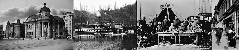
Vancouver as a port city
![Aerial view of Vancouver, B.C., looking north, circa 1932.<br>
<em> Image: City of Vancouver Archives. [CVA 677-712]](https://story.vancouver-historical-society.ca/wp-content/uploads/2014/11/CVA-677-712.jpg)
Image: City of Vancouver Archives. [CVA 677-712]
“I think it must have been in 1892 that we had a smallpox scare in Vancouver. It was supposed to have come from the “Empresses” from the Orient, for hardly anyone who had anything to do with the Empress of China, Empress of India, or Empress of Japan, the C.P.R’s first yacht-like liners, escaped it.”
Mr. J. Z. (Greer) Hall, 1931 (Early Van.)“Of course, you know the first CPR station in Vancouver was built over water, on stilts, the water was underneath the station.”
George L. Schetky, pioneer of February 1886 (Early Van.)“By all means, let us be up and doing and get this seaport of ours into shape for the business which surely will come with the opening of the Panama Canal…But it will be well to have more business and less politics in the doing of it.”
N. Thompson, April 25, 1912 (Van. Sun)“False Creek is nothing more than a filthy ditch in the centre of the city.”
newspaper ad for election campaign of Jack Price, 1950
![Crowds watching C.P.R. ship Abyssinia leave dock
at foot of Granville and Howe Streets, circa 1887.
Image: City of Vancouver Archives. [SGN 307]](https://story.vancouver-historical-society.ca/wp-content/uploads/2014/11/SGN-307.jpg)
Vancouver took off as a port with the arrival of the CPR transforming it from “a skid road port into a thriving entrepôt”[1] connecting ocean and inland trade. It completed Britain’s ties to Asia across Canada, shipping tea to from China to London via Vancouver in record time.[2] This was followed by silk, given priority on the “silk trains.” In the 1890s and early 1900s, the CPR built an impressive fleet of ships, first wooden, then steel-hulled to advance this imperial trade.
![C.P.R. steamer Empress of China at docks. Vancouver, BC, circa 1893.
Image: City of Vancouver Archives. [Bo P85]](https://story.vancouver-historical-society.ca/wp-content/uploads/2014/11/Bo-P85.jpg)
Other shipping companies diversified port activities. From 1889, the Union Steamship Company serviced small communities up and down the coast. By 1911, four shipping companies were operating from Vancouver.[3] In 1913, anticipating shipping opportunities to come from the soon-to-be-opened Panama Canal, a project to develop a harbour on False Creek called for the sale of the Snaug Indian Reserve.[4] In 1914, unbridled enthusiasm for the port’s future as a shipper of prairie grain brought Vancouver’s first grain elevators to south shore of Burrard Inlet.[5] WWI led to shipping contracts on both sides of Burrard Inlet but the end of the war saw business shrink considerably.
![Western Canada Shipyards Ltd, Vancouver 1918.
Image: City of Vancouver Archives. [PAN N2488]
Click image to enlarge](https://story.vancouver-historical-society.ca/wp-content/uploads/2014/11/PAN-N2488.jpg)
The opening of the Panama Canal led to the emergence of a substantial grain trade through Vancouver harbour in the 1920s. During the Depression of the 1930s business again dropped significantly. In WWII,[6] a more militarized port took shape with shipyards and secondary industries on both sides of Burrard Inlet and False Creek expanding dramatically.[7] After the war, many west coast companies purchased the decommissioned marine merchant vessels.
![Launching of ship from West Coast Shipyards (False Creek), 1942.
Image: City of Vancouver Archives. [Bo P384]](https://story.vancouver-historical-society.ca/wp-content/uploads/2014/11/Bo-P384.jpg)
Since that time, under the Vancouver Port Authority the port has expanded greatly, accommodating an ever-growing Asian-Pacific container industry. The Asian recession in the late 20th century saw a downturn in port activity but the rise of China has brought it back. Since the 1980s cruise ships have generated considerable activity in the port and a new Waterfront Convention Centre built for the 2010 Winter Olympics has given the port a greater diversity and vibrancy.
![Port of Vancouver today.
Image: Flickr [Michael Scheltgen]](https://story.vancouver-historical-society.ca/wp-content/uploads/2014/11/VancouverPort.jpg)
Expansion, incorporation of neighbourhoods
and the role of streetcar routes
“Not more than twenty-five cows shall be kept by any one person, family, partnership, company or corporation at any one time within the…limits of the city”
City By-Law no. 263, January 16, 1902“…it is not (an) exaggeration to state that, for its size, Vancouver can show more new buildings erected during the past year than any city on the Pacific coast and probably in America.”
The Province, January 9, 1904“Carmichael, of the B.C. Electric Railway, (Vancouver Electric Railway?) took the first five cent fare in 1890. As the car came out of the barn, a man jumped on and gave him a five cent piece. He kept it, and has it yet.”
Mrs. Percy Nye, 1932 (Early Van.)Gradually the bicycle craze died down and the streetcar system was extended into even remote and sparsely settled districts; then the motor car came. The bicycle paths fell into disrepair and finally disappeared.”
Archivist, James Skitt Matthews, 1931 (Early Van.)
![View of Cordova Street looking west from Carrall Street
View of Cordova Street looking west from Carrall Street, 1890.
Image: City of Vancouver Archives. [CVA 1376-324]](https://story.vancouver-historical-society.ca/wp-content/uploads/2014/11/CVA-1376-324.jpg)
Vancouver is a city of neighbourhoods. Each has been defined by three factors: the original surveyed, gridded district lots, the people who were drawn to each, and the streetcar routes which gave birth to business and social life.[8]
![Line-up at the foot of Granville Street to purchase lots in Shaughnessy neighbourhood from the C.P.R., 1909. Image: City of Vancouver Archives. [CVA 677-526n]](https://story.vancouver-historical-society.ca/wp-content/uploads/2014/11/CVA-677-526n.jpg)
The original Granville Townsite Reserve, which stretched from Gastown to False Creek, continued to reflect the large diversity of those workers who had settled around the Hastings Mill. Gastown drew in workers and loggers who, at the end of their effective job lives, could rent affordable one-room units. A thriving Japantown and Chinatown became the focus for Asian social life in Vancouver. To the east of Chinatown was a workers’ residential area (Strathcona,[9]) made up of people of Jewish, Italian, and Chinese descent. It also included an enclave of African Canadians known as Hogan’s Alley. The eastside area reflected Vancouver Improvement Company’s (VIC) vision for the city’s development, which consisted of the main arteries of Hastings east of Cambie, Cordova, Westminster (now Main), and Commercial streets[10] as the commercial centre of Vancouver. Banks, theatres, stores, libraries, and an early City Hall were evidence of this optimism. Indeed, a lively business district continued to thrive into the 1950s, with Woodward’s Department Store, the Interurban tram depot and the Burrard Inlet ferry drawing human traffic to the area. When the Interurban line closed in 1954, the Burrard Inlet ferry from the North shore stopped running, and large numbers of people were no longer transported to this part of Vancouver, it began a steady decline. The flagship Woodward’s store eventually closed in 1993.[11]
The CPR’s downtown business district, which was a significant segment of the CPR’s total land endowment, helped define the East-West division of the city. The CPR Land Commissioner[12] aligned the streets, more or less,[13] with those of the 1870s West End grid claim bordering Burrard Street rather than following the alignment of the earlier Granville Townsite grid. As the CPR could not lay tracks through Gastown and to avoid the elevated escarpment, it laid tracks on elevated trestles over the water along the Granville Townsite harbor to its own land holding. The main street was laid out at right angles to the CPR rail terminus. The biggest and best buildings along the streetcar route of Granville Street[14] outclassed anything in the former Granville Townsite. Even the street name “Granville” was appropriated from its pre-incorporation neighbour.
![Photograph shows three different views
of the interior of the Vancouver Opera House, c. 1891.
Image: City of Vancouver Archives. [CVA 371-2389 ]](https://story.vancouver-historical-society.ca/wp-content/uploads/2014/11/CVA-371-2389.jpg)
Additionally the CPR strategically rushed into completion “a wholly unornamented five-storey brick-and-stone building” hotel at the corner of Granville and Georgia,[15] the original plans being lost in the Great Fire. Likely because of the plainness of the hotel and in order to attract more sophisticated buyers to the area, in February 1891, the CPR opened a 2,000 seat nearby Opera House. They operated until the economic downturn in 1912 and in 1913 began showing vaudeville acts.[16] In 1913, the company also began demolishing its barn-like hotel, replacing it in 1916 with a lavishly oversized and visually impressive hotel attesting to the CPR’s opulent corporate grandeur and semi-regal mantle, albeit on the wane, in Vancouver.
![Boulevard and homes in Shaughnessy, c. 1920.
Image: Vancouver Public Library. [VPL11353]](https://story.vancouver-historical-society.ca/wp-content/uploads/2014/11/VPL11353.jpg)
Apart from the Coal Harbour segment that was sold off for industrial purposes, the old Bricklayer’s Claim, aka the West End, retained its distinctiveness as a residential area. Large stately homes of the city’s affluent were part of the early mix of housing until the upper class began abandoning the area before the First World War for the newly developed and exclusive Shaughnessy. The grand homes of the West End suffered the indignity of being subdivided into rental units until decay and redevelopment saw to their demise in the 1960s and 1970s. The original streetcar line coursing its way through the Robson-Denman-Davie street corridor defined the business and social activity that remains today. Just a block or two either side of the streetcar line, warmly inviting, three-storey walkup buildings were constructed in the 1920s to accommodate single people, mainly single women, who worked downtown. Most of these buildings remain today and many West Enders choose to walk downtown, making them very fit indeed.
![View of Hastings Street looking west from Homer Street, 1927.
Image: City of Vancouver Archives. [Str N195.1 ]](https://story.vancouver-historical-society.ca/wp-content/uploads/2014/11/Str-N195.jpg)
The Hastings Townsite to the east remained outside Vancouver until 1911 when the bypassed landowners voted overwhelmingly to join the City of Vancouver. This amalgamation completed Vancouver’s eastward extension to Boundary Road. Early streetcars took people seeking recreation from Vancouver along Hastings Street to the large Hastings Park and the annual fair that began in 1910 and eventually became the Pacific National Exhibition. Its remaining wide streets[17] are a reminder of the original plan for it to be the centre of a new city.
![National Pacific Exhibition midway at Hastings Park, circa. 1936.
Image: City of Vancouver Archives. [260-503]](https://story.vancouver-historical-society.ca/wp-content/uploads/2014/11/260-503.jpg)
South of the city of Vancouver’s 1886 boundary of 16th Avenue a different dynamic was taking place. The large land concession[18] in that area, originally assigned in 1885 to two CPR officials and later put under direct control of the company, sprang to life in 1907 with the development of an exclusive upper class neighbourhood called Shaughnessey Heights. With its irregular, gracefully winding streets, it marked a social and physical differentiation from the more common, predictable grid-like streets of Vancouver.
![Point Grey Fire Hall No. 18, 38th and Cartier c. 1924.
Image: City of Vancouver Archives. [CVA 677-697]](https://story.vancouver-historical-society.ca/wp-content/uploads/2014/11/CVA-677-697.jpg)
The yet-to-be Vancouver from 16th Avenue to the North Arm of the Fraser River and west to Point Grey was created as a separate municipality of South Vancouver in 1892. However, in 1908 the area west of Cambie Street separated from South Vancouver to become the municipality of Point Grey. The latter excluded the government reserve in Point Grey that was to remain a Provincial Crown possession and became known as the University Endowment Lands, incorporating the University of British Columbia. In 1929, however, both the municipality of Point Grey and South Vancouver amalgamated with Vancouver, completing Vancouver’s footprint.[19]
Railroads, public transit and roadways as mobility factors
“Mr. Morton and I came over from New Westminster one summer’s day in 1884 for an outing…We had to buy our tickets for the stage the previous day, and afterwards we drove over the Old Hastings Road, then a corduroy road through the trees.
Ruth Morton, 1932 (Early Van.)“In December 1899 Burrard Street beyond St. Paul’s Hospital was a mere wagon trail of mud twisting in and out between stumps; a two plank sidewalk ran on the west side as far as Beach Avenue.”
Archivist, James Skitt Matthews, 1931 (Early Van.)“Older Cities are spending millions to rectify mistakes of the past. Vancouver had made great mistakes, our streets that might have been wide twenty-five year ago are all too narrow now.”
Ed Hewitt, June 25, 1912 (Van. Sun)
![North Arm Road (Granville Street) near 36th Avenue looking south, 1895.
Image: City of Vancouver Archives. [Str P156]](https://story.vancouver-historical-society.ca/wp-content/uploads/2014/11/Str-P156.jpg)
While the CPR had made Vancouver a railway town, other railroads soon broke the dominance of the CPR. Early on, the CPR monopoly was beginning to show fault lines when CPR plans to industrialize the shores of English Bay and Kitsilano did not materialize. By 1904, the civic and provincial governments sought to encourage competition to the unpopular CPR.[20] That same year the CPR lost its transcontinental monopoly when the Vancouver, Westminster and Yukon Railway (VW&YR) crossed the Fraser and entered Vancouver from the South, using the Great Northern Railway line (Burlington Northern) and establishing a terminus in Chinatown. In 1915 the CPR trans-Canada monopoly was broken when the Canadian Northern Railway (CNR) arrived from the east. The CNR then established a terminus that filled the tidal flats from Main Street to the east end of False Creek and in 1923, merged into the Canadian National Railway (CNR).
![Early streetcar on Denman Street, 1895.
Image: City of Vancouver Archives. [M-3-18.2]](https://story.vancouver-historical-society.ca/wp-content/uploads/2014/11/M-3-18-2.jpg)
Vancouver’s electric streetcar system, begun in 1890 and once the pride and joy of the city, came to an end in 1950s when it was overtaken by the onslaught of cars, buses, growth in suburbia, aging infrastructure and, to a lesser extent, narrower streets that could not accommodate both cars and streetcar tracks and intrusive traffic islands. The Interurban Line which had connected its terminal in Gastown to New Westminster, Richmond and Chilliwack came to an end around the same time. Unlike other North American cities where the automobile industry actively engineered the demise of streetcars, there was no such conspiracy in Vancouver. As tracks, wooden street car bodies and overhead trolley wires had all worn out,[21] they were replaced with overhead electric and diesel-powered buses overseen by the Urban Transit Authority (now Translink). Nonetheless, the decision to bring the streetcar system to an end deprived Vancouver of a rich streetcar history as well as a rich and effective infrastructure for moving large numbers of people through the city’s neighbourhoods.
By the 1930s, most of Vancouver’s roads had been built. However, the important Harland Bartholomew 1929 Plan for Vancouver, which aimed to widen and rationalize main arterial roadways, was sidelined by the Great Depression and WWII.[22] In the 1960s the City Planning Department was swept up by the attractions of large-scale planning and the apparent benefits that freeways brought to North American cities. Massive road systems such as the Ocean Parkway,[23] which involved a causeway that cut across English Bay and connected to a wide throughway cutting across Stanley Park, were entertained. In 1967, an American freeway planning consulting company presented to Vancouver City Council its Vancouver Transportation Study, a plan to transform the city with freeways, including one through Chinatown. The plan garnered such opposition from the excluded Vancouver public, creating what has been called Vancouver’s “Great Freeway Debate,” that it was shelved. The mayor, Tom Campbell, a developer himself, gained something like pariah status for his support for freeways and was replaced by a reform Council in 1972.[24] By 1995 City Council had adopted a City Plan that engaged the community in large-scale planning decisions.
![Skytrain from the Viaduct
Image: Flickr [jmv]](https://story.vancouver-historical-society.ca/wp-content/uploads/2014/11/Skytrain.jpg)
Having washed its hands of internal freeways and planning around the automobile, Vancouver has focused on developing transit infrastructure. Busses, the elevated “Skytrain” of 1986[25] and the subterranean “Canada Line” of 2010[26] have generated a significant rise in the residential density of the downtown peninsula and in cross-town nodes like Metrotown without an equivalent growth in automobile traffic. A 1960s plan to widen roads in the West End to accommodate more automobiles was turned on its head when City Council a decade later converted street sections to parks, intentionally interrupting West End routes. While automobile use subsequently went down, the desirability of the neighbourhood went up. Likewise, the recent introduction of bike lanes, besides reducing the level of air pollution,is also decreasing the need for automobiles in the city.
![Separated Bike Lane on Hornby Street Image: Flickr [Paul Krueger]](https://story.vancouver-historical-society.ca/wp-content/uploads/2014/11/BikeLane.jpg)
- Delgado, Waterfront, p. 50↵
- Lyon, “Port of Vancouver,” in Davis, The Greater Vancouver Book, 487-90.↵
- Union Steamship Company, Hamburg Amerika, Royal Mail Steam Packet and the East Asiatic companies, Delgado, Waterfront, 80.↵
- The Panama Canal opened in 1914. In 1913, money that had been put aside by the Provincial Government was used to purchase the somewhat depopulated Snaug Reserve at a time when port shipping was extending its reach.↵
- The grain elevator, initially dubbed “Steven’s Folly” after politician Henry Herbert Stevens (1878-1914), attracted little business at first but in the long run proved pivotal to the city’s emergence as a grain port.↵
- After a week of deliberation, Canada entered WWII on September 10, 1939 as a largely independent state and although its 1.1 million troops saw service in Europe and on the Atlantic Ocean, the country was still technically at war until Japan’s surrender on September 1945. During the six years of war, 45,000 were killed and 54,000 wounded. Because this war was also fought in the Pacific, Vancouver benefited from wartime enterprises.↵
- The “Dominion Bridge Co. and Western Bridge & Steel Fabricators produced the steel plate, while Vancouver Engineering Works and Progressive Engineering cast propellers and machinery. Westland Iron & Steel Foundries cast anchors and other fittings, and Vancouver Iron Works made boilers.”Delgado, Waterfront, 121.↵
- Vancouver’s first boundaries that defined its neighbourhoods were Stanley Park to the west, Nanaimo Street to the east, and to the south of to 16th Avenue between Trafalgar and Ontario Streets. CPR holdings actually carried on south of 16th avenue into the unincorporated farming area to 57th Avenue area (City of Vancouver Archives, map 86) and abutted various districts lots claimed by individuals.↵
- Atkin, “Strathcona”, in Davis, The Greater Vancouver Book, 86.↵
- These streets had been given the maximum width of 1.5 surveyor chains (30.2 meters or 99 feet).↵
- Within the last decade the iconic Woodwards store has become one of the focal points for the redevelopment and gentrification of this area. As well, older formerly substantial buildings have been converted into public housing to take care of the homeless and poor, also traditional elements of this area.↵
- Laughlan Hamilton, 1852-1941, also served as Vancouver city councillor.↵
- Not all the streets of the West End and its neighbour the CPR land concession joined as streets in the West End bordering Burrard Street followed an earlier survey and when tested by Hamilton’s resurvey in 1886, were found to be inaccurate and somewhat irregular. The downtown survey was much more regular.↵
- Slightly narrower than the usual main arteries at 25.9 meters or 85 ft.↵
- >Harold Kalman. “Thomas Charles Sorby: 1836-1924,” in Luxton, Building the West, 126.↵
- The splendour of the Opera House obviously worked its magic for several international personalities ended up buying lots within the CPR concession. Vienna born soprano, Emma Juch as well as Rudyard Kipling were just two who ended up buying several lots.↵
- Visually very wide at 30.2 meters or 99 feet.↵
- This area outside the boundaries of the 1886 Vancouver included everything between the modern Trafalgar and Ontario streets south to about 57th Avenue.↵
- Smedman, 117-120↵
- Mitchell “Railways in Greater Vancouver,” in Davis’, The Greater Vancouver Book, 447.↵
- Kelly,”History of Transit,” in Davis, The Greater Vancouver Book, 455.↵
- Vancouver planning took on various forms from 1916 with the Civic Improvement League, 1919 a Vancouver branch of the Town Planning Institute,. The Vancouver Town Planning Commission, responsible for hiring Bartholomew, was formed a year after the Town Planning Act of British Columbia was passed in 1925. Hayes, Historical Atlas of Vancouver, 86.↵
- Put forward in October 1960. Illustration in Hayes, Historical Atlas of Vancouver, 159↵
- Hayes, 154-159; a similar revolt took place three years later when the architecture at the Eaton’s/Pacific Centre downtown development was borrowed from, and quite appropriate to elsewhere, but not Vancouver. From that point on, Vancouver architects designed most of the buildings in the downtown Vancouver area.↵
- A showcase but peripheral part of Expo 86 development.↵
- A key transportation link developed for the 2010 Vancouver Olympics.↵